.png?width=400&height=400&ext=.png)
Remote sensing in geotechnics
by Andrew Lees, on January 30, 2020
Remote sensing techniques are an important tool in the modern ground engineer’s armoury, helping build ever-more accurate ground models for construction and geotechnical asset management.
Tensar Ground Coffee - Episode 7 Andrew discusses remote sensing in geotechnics
The more accurate a ground model, the more geotechnical engineers are able to design to actual ground conditions, to deliver more appropriate solutions, mitigate ground risks and, ultimately, add more value to projects.
Ground models are nothing new, of course. They are created from a number of data sources: borehole and trial pit samples and in situ tests; laboratory tests, field instrumentation and topographical surveys. This data is combined to build up a 3D picture of the ground.
In the past, ground models comprised cross sections and maps but technological advances, particularly around remote sensing, combined with access to cheap computing power, has meant that today’s ground models are dynamic, changing over time as new data becomes available – from pre-construction, through construction and into operation of infrastructure assets, such as roads, railways and pipelines.
Two key tools are Interferometric synthetic-aperture radar (InSAR) and Light Detection and Ranging (LiDAR).
InSAR
InSAR uses two or more radar images from satellites to create maps showing ground displacement. Combining data over time enables measurement of ground movements to millimetre accuracy, making the technique very useful for monitoring displacement of large civil engineering and geotechnical structures, such as embankments, cuttings and retaining walls.
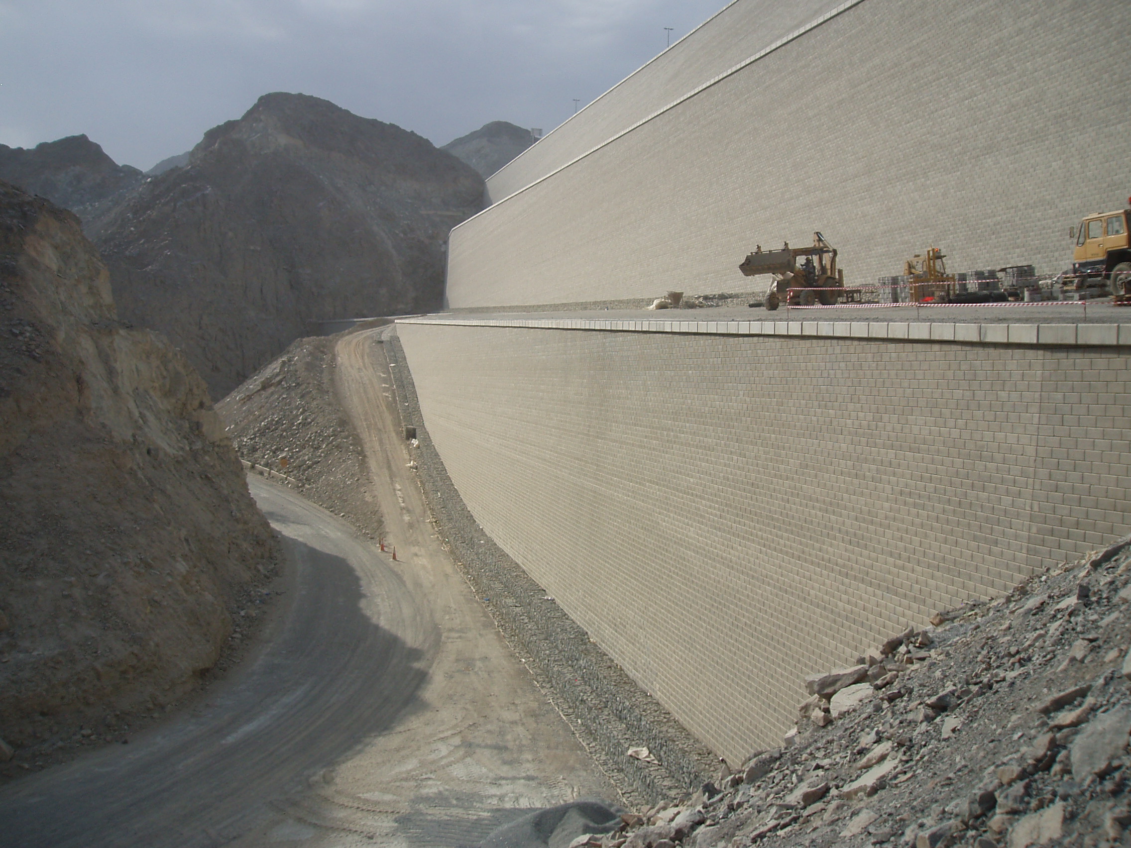
Tensar used InSAR to monitor the displacement of the 60m high mechanically stabilised earth walls built in 2009 for the Dubai-Fujairah Freeway. We were able to determine that, between 2014 and 2018, the walls were moving less than 2mm per year (the yellow and green dots) – significantly less than the 4 to 7mm annual movement of the surface of a nearby unreinforced embankment slope (the orange and red dots).
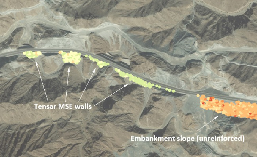 Fijairah wall, dubai as seen via InSAR. To read the full case study see here.
 The Fijairah Freeway connects the Dubai in the west, to Al Fujairah on the east coast.
LiDAR
LiDAR uses beams of light to map the surface. LiDAR surveys can be carried out from the ground or from the air, using drones and aircraft. Ground models created using LiDAR can be used for surveying (as part of a site investigation, for example) but LiDAR can also be used to measure ground movement, which is particularly useful in monitoring geotechnical hazards such as slope instability and faults in seismic regions.
While there is no substitute for physical investigation of the ground, the ability to build a more comprehensive, and dynamic, picture of the ground using remote sensing is certainly a boon for the geotechnical industry. Plus, ground models are also increasingly feeding into Building Information Modelling (BIM), benefiting the entire construction process.
These tools enable engineers to develop efficient designs to minimise geotechnical risk, with minimal environmental impact. They also allow monitoring of geotechnical structures during operation, so that maintenance can be better-targeted, delivering savings throughout the lifetime of an asset.